copyright

All stories and photos on this site, Earthy Reporter, are the property of Carola C. Reuben and cannot be used elsewhere without prior written permission from Carola C. Reuben. Just ask. I will probably say yes.

Saturday, December 3, 2011

Part 2, Chapada Revisited: Aging City Dropouts Blend with Development in Brazilian Wild West

The children with plant names were fidgeting around their home in Chapada dos Guimaraes when I emerged from the thick greenery.
It was 1991; my nephew, Haloa (whose name means Field of Flowers in the native Indian language Tupi-Guarani), was then 2. He was outside splattering mud up to his neck. Inside the house, my niece, Iuca, (Manioc Root in Spanish), 5, was tugging at her mother’s skirt. My niece, Lotus, 8, ran to hug me.
Cida’s other children, not my nephews, were Ginseng, then 12, and the howling infant Caiubi (Blue Leaves in Tupi-Guarani.)
In spite of the commotion, their mother, Cida, seemed relaxed. My arrival after three years was a surprise, but she greeted me casually, “Oi, tudo bem?” (Hi…everything all right ?)
Cida bore three more children during the next 10 years, Radharani ( wife of Krishna, Completeness in Sanskrit ), Iasmim (Jasmine), and Hermano (Brother in Spanish). She would have had nine children, but she lost one when a snake bit her during pregnancy. So, she only had eight.

Cida makes music with grandchild Isabela. Behind them: Radharani
 The 1991 visit was my third in six years. Usually, I managed to leave the US in January during those years when I was publisher of Mundo Hispanico, Atlanta’s Hispanic community newspaper.
Then I stopped visiting Chapada. My brother, Mike, had separated from Cida (before 1991), and their three children eventually went to live with him and go to school in Sao Paulo.
Now after more than 20 years, I finally visited Chapada. Cida, 56 (photo, top right), still lives in the small wooden house built by Mike about 30 years ago when he was 18.
Fruit trees fertilized with his children’s placenta still grow in the front yard near woods full of monkeys and coatis. A river flows about half a kilometer behind the house. Using buckets of water he fetched from that river, Mike had delivered two of his children.
As always, Cida (short for Maria Aparecida ) cooks by wood fire. She has had running water for many years, and electricity became available in her area several years ago. A sign that says “seamstress” and another that advertises “whole grain bread baked by wood fire” hang on her fence by the deep green road ( see photo, previous post).
After relationships with the three fathers of her children, Cida says she chooses to be alone, with God only. She attends a group that uses mantras and prayers as “a way to go inside yourself.” Her spiritual practice seems to mix vegetarianism, reincarnation, Jesus, and more.
Some of her “alternative community” neighbors from the 1980s continue to live on her road, including Jorge in the Indian hut (see previous post). Nearby, another old-timer, Helio, still spends his nights in a hammock on the porch of his brick house (photo below). Since he sleeps outdoors, he says, “I don’t even know why I have a house.”
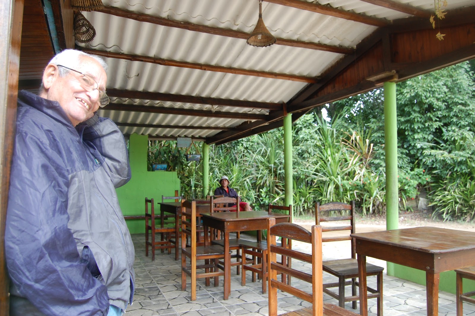
His rustic kitchen has a view of the woods (photo above, Helio in foreground ); there he talks about running away from home about 30 years ago the day he was scheduled to register for college in the city of Recife.
Now he makes a good living as a specialized guide who leads people to wild animals in the nearby Pantanal, one of the world’s largest wetlands.
He complains about deforestation in Chapada. Vacation homes have been sprouting around him for two decades. Less than a mile away, the high walls of gated communities, Condominio Jamaca Village I and II, jut out of the woods like an urban nightmare.
Another city dropout from his era, Mario, keeps a home in Chapada, made of hand-made bricks. However, during recent years he has been living in the wilder west of Vila Bela da Santissima Trindadade near the Bolivian border.
When Mario, now 51, arrived in Chapada about 30 years ago, he stayed very close to the animals he was photographing. He lived in a one-room hut deep inside the woods near the waterfall on his property (photo, top of post, right). It serves as the neighborhood pool.
Now an established photographer, Mario Friedlander posts wlidlife and scenery shots on his facebook page. He also puts links for petitions to save the Amazon.
During my visit to Chapada, Mario was in town taking pictures of Chapada’s winter music festival for the municipal government, which now presides over a population of more than 17,000.
In that municipality, the dropouts of the 1980s have left  imprints (see upcoming story, Part 3). However, Mario insists with a tone of utter disgust: “This has turned into a place for the bourgeois.”
Story and photos by Carola C. Reuben, Earthy Reporter, copyright 2011
TO BE CONTINUED SOON...PART 2 OF A 3 PART STORY
earthyreporter@aol.com

Sunday, November 13, 2011

Part 1, Chapada Revisited: Aging City Dropouts Blend with Eco-Tourism in Brazilian Wild West


Youths escaping from urban lifestyles arrived in Chapada dos Guimaraes long before the slogan, Mecca of Eco-tourism, appeared on the town’s welcome sign.

Back in the 1980s before “eco-tourism” became a common term, I watched the young settlers celebrating nature. They bathed naked in waterfalls and smoked pot in the wilderness. Some planted fruit trees and organic vegetables. Some made whole grain bread and babies.
They found paradise in Brazil’s wild west in a region of steep cliffs at the edge of a plateau in the state of Mato Grosso do Sul.
Some of the youths I met in the 1980s still live in Chapada. Now they are 50ish or older, and many make a living from the development they reject.
Jorge, who stayed in Chapada, once tried to stop development by darting out naked on the dirt road in front of his property whenever he spotted land buyers. He wanted to scare them away, but people from the nearby city of Cuiaba kept building vacation homes.
Jorge’s green road in the Jamaca valley (photo, left ) is no longer the exclusive domain of the “alternative” community. However, his lifestyle remains much the same, though now he complains bitterly about having arthritis.
Jorge, 56, still lives in the Indian hut he built (photo bottom of post.) The blood of three races runs in his veins, but he says he finds refuge mostly in his Indian heritage. He frequently visits the Xavantes, one of the tribes in the region. Like the Xavantes, he wears several inches of wood in each ear; the Indians use the pieces to dream and to make predictions.
Jorge abandoned an urban lifetyle some 27 years ago when he suddenly quit his job as manager of an insurance company in nearby Cuiaba. He subsisted mainly on agriculture and playing guitar at a bar during his first 15 years in Chapada.
Finally during the last 12 years, Jorge ( photo, top left), started making a living from the outsiders he once tried to repel. As a guide, he takes “eco-tourists” into the wilderness, where he keeps extending his arms towards the scenery while he exclaims, “What a show ! It activates your internal energy.”
Jorge tells eco-tourists about medicinal plants in the cerrado, the tropical savannah that covers much of the region. For example, some leaves cure burns; others aid constipation; some can be used as nail files.
Jorge contends that if people were aware of what the cerrado contains “we would not be using it to plant soy beans or polluting its rivers with agro toxins.”
By a river surrounded by enormous rocks, he then points out a place to view jaguars. He picks up what he says is a fossilized sea shell, a way to touch the remote past when the cerrado was allegedly covered by ocean.
Then there are the unique plants thriving in the fierce heat of the dry season (August, September.) One of them, the pepalantus (photo above, right), was nicknamed “abacaxi lunar”( lunar pineapple ) by Jorge’s fellow malucos (freaks).
Jorge and his companions are passionate about their surroundings. However, to them Chapada means more than a natural wonderland. One early settler, Cida, calls Chapada a sacred planetary center.
The geographical center of South America is located in Chapada, and the exact speck that marks the middle of the continent is considered a “power spot.” The pioneers also vested Chapada with spirituality because of their belief that UFOs landed there and humans inhabited the region during ancient times, according to my brother, Mike, one of the earliest refugees.
Now that magical center of South America is behind the locked and guarded gates of the National Park of Chapada dos Guimaraes, some 81,545 acres set aside about 20 years ago. Today people may enter that area only with registered guides, unlike the time Jorge and his friends roamed freely among cliffs and waterfalls now inside the park.
Even though Jorge’s passion became his vocation, he misses a wilder time before he blended with eco-tourism. It is a conflict he shares with other refugees from his era ( See Part 2. To be posted soon.)
Story and photos by Carola C. Reuben, Earthy Reporter, copyright 2011
TO BE CONTINUED…. PART 1 OF A 3 PART STORY…
earthyreporter@aol.com

Friday, July 29, 2011

Fandango, 'Twist and Shout' Grace Fish Festival

The talk of the village was the scant catch of tainha fish. The fish were not jumping into fishermen’s nets just days before the annual festival to celebrate the abundance of tainha. The seasonal fish usually surfaces in fishermens’ nets during the Brazilian winter (July, August ).
Barra do Una beach, where tainha were scant before festival
 The tainha refused to cooperate, but the people were busy preparing for Festa da Tainha in Barra do Una, a village in Brazil’s largest Atlantic coast preserve, Estacao Ecologica de Jureia-Itatins in the state of Sao Paulo.
Villagers were erecting booths, and raffle tickets were selling fast. After all, each ticket was a chance to win national soccer star Robinho’s autographed T-shirt.
Una River at the end of Barra do Una beach
Musicians were getting ready to play the songs of the caicara (coastal backwoodsman ) on hand carved instruments. Deep inside the wilderness, a dance with fandango music had always been a way to celebrate a harvest or to thank neighbors who helped buid one’s house.
Meanwhile, the night before the festival, my neighbor, Benedito ( “Dito”) reported that he did not catch tainha. “Nemhum” (not one), he said emphatically. He was walking on the muddy road in front of our houses on his way back from the beach.
Finally, the day of the festival, Diego (photo, right), said with a radiant smile, “We caught 99 tainha last night.” The tainha are very smart, Diego explained, and a special triple net is used to catch them.
That evening the tainha roasted on portable charcoal stoves in booths beneath rows of small, multi-colored flags. The fish emerged from their tin foil covers, plain and barbecued, or stuffed with caviar, crab, shrimp, or banana.
People were feasting to the beat of “Dancing Queen“ and “Twist and Shout.” Then suddenly the twist stopped blaring from loud speakers, and fandango music penetrated the wilderness. A singer droned in a mournful tone; musicians played on three handmade guitars, drums, and a tambourine.
The performance was just like the ones from the time when musicians traveled all day on foot or on horses to bring fandango music to a festivity, said Jorge Paulo Silveira, a lover of traditional lore.
The only difference today is the amplification of the music with electronic sound equipment, Silveira said. Silveira, an employee of the Cultural Department of Peruibe, the town closest to the preserve, is also a volunteer for Nacao Caicara (Caicara Nation), a dvision of the non-profit Institute of Studies and Conservation of the Atlantic Coast Wilderness. Caicara Nation was sponsoring the traditional band.
Meanwhile, hundreds of people arrived, including villagers, city dwellers with vacation homes in the village, and other people who traveled on the mountainous, rocky, dirt road, the only one that leads to the village.
Dancers kept rocking back and forth to the monotonous music, and as promised by posters for the event, the fandango music sounded “ate o sol raiar” (until the sun rises ) inside the preserve's 792 square kilometers of wilderness.
Story and photos by Carola C. Reuben
Copyright, 2011, Carola C. Reuben, Earthy Reporter
earthyreporter@aol.com

Saturday, June 11, 2011

Ride in Brazilian Wilderness Ends at Walter's Bar


Alternative to canned sardines at Walter's: Fish on Barra beach
As the bus climbs uphill on slippery mud in Brazil’s largest Atlantic coast preserve, the engine makes a deafening “whirrr” sound. Then the bus slides down a steep hill, hits boulders, and makes a stomach-churning lurch.
A passenger shouts, “Nossa !” Her exclamation is short for “Nossa Senhora do Ceu” ( Our Lady in Heaven ), a plea to the Virgin Mary.
However, the Virgin Mary does not rescue her. The bumpy ride continues on a dirt road just slightly wider than the bus.
The public bus had left from the seaside town of Peruibe on a 22.5 kilometer ride through Estacao Ecologica de Jureia-Itatins, a federal preserve that covers 792 square kilometers of Atlantic coast wilderness on the southern coast of Sao Paulo state.
The bus rattles along dense green wilderness dotted by the red of tiny tulip-shaped flowers. Glimpses of ocean or waterfalls appear suddenly through the forest. Horses graze against a mountain backdrop. In front of a few houses, signs announce the sale of turkeys or fish.
Meanwhile, Jalmir, the jovial cashier (photo below), raises his voice above the clatter of the bus to chat with passengers he knows from working on the route for seven years.
“See you later, Mateus. Find yourself some women,” Jalmir yells in Portuguese as one man gets off the bus. Then he asks Joao to say hello to “Chupa Cabra” (Goat Sucker ), a nickname for Joao’s neighbor.
Some passengers step off the bus near a lone brick or plaster house. Others get off next to giant ferns, bamboo groves, and trees 30 or 40 feet tall, where no houses are visible.
At least today the bus does not break down, leaving children who go to school in Peruibe and other passengers with no other choice but to walk home.
The passengers are part of the preserve’s sparse human population. Some 315 native families, including squatters and others who subsisted on agriculture or fishing, were counted in 2005 by the Brazilian government’s environmental agency ( Secretaria do Meio Ambiente ).
City dwellers with vacation homes, such as members of my family, are not included in that figure. The agency recorded a slight population decrease since 1987 when Jureia became a preserve. Construction of new homes was no longer permitted, and other prohibitions were implemented, such as the ban on hunting.
Meanwhile on the bus, papayas roll out of my shopping bag onto the floor while I cling to the lime green metal bar on the seat in front of me with one hand, and with the other, I clutch a laptop in a padded case.
The Japanese-Brazilian man, known as “O Japones”, grips the ends of two huge plastic bags of dog food on the floor next to him. That purchase was his reason for the four hour roundtrip journey, 22.5 slow kilometers (13.5 miles) each way .
O Japones” lives in Barra do Una, home to 43 native families, according to the 2005 government census. The government agency counted a total of 129 houses/lots in Barra, including vacation homes. Barra do Una is a populated speck in the largely uninhabited preserve.
People wait for bus on only road that leads out of  Barra. 
At last the bus clangs to its final destination at Bar do Walter. The bar has been a fixture in Barra do Una for 23 years, some 10 years after the road to the village was built in 1978.
The owner of the bar, Walter, 73, (photo, top of post ) serves beer and cachassa ( a sugar cane alcohol ), and sells canned sardines, insect repellent, Coca-Cola, cigarettes, eggs, and crackers.
The bar stays open seven days a week, 6:30 a.m. until the last client leaves at night. It closes only when heavy winds blow dirt around the bar. Helio, Walter’s son, explains the reason for the bar’s long hours. “There isn’t much else here.”
Story & photos by Carola C. Reuben, Earthy Reporter, Copyright, 2011
earthyreporter@aol.com

Friday, May 20, 2011

'ROSES CAPTURE MELBOURNE'S ESSENCE'

On a street like many others in the Melbourne, Australia area, the red, yellow, and apricot shades of roses cascade from the yards. They bloom in violet and pink from the tops of fences and behind wrought iron railings. Sometimes they squeeze together in front yards only five feet wide.
On this particular street, Lyndhurst Crescent in suburban Hawthorn, one rose garden grows in homage to the late postman. As Hawthorn resident Felix Carrady tells the story, the old postman adored his roses, and his daughter keeps them blooming in his memory (photo above). The rose gardens photographed here are a small sampling on a few blocks of just one suburban street.
Melbournites view more formal rose arrangements in Melbourne’s more than 100 parks during spring. For one, the Royal Botanic Gardens Melbourne boasts more than 200 different species and varieties of roses. The flowers appear against a backdrop of buildings (photo, right).
Some roses have foreign origins; others, Australian bred, have Aussie names, such as Onkaparinga. According to the website, Burke’s Backyard, the roses withstand the country’s climate extremes, including summer days when temperatures climb to 40 degrees centigrade (104 Fahrenheit ).
Last Australian spring (November) followed years of drought so severe that just “a teaspoon of water is left at the bottom of what was a river,” exaggerates Hawthorn resident Zieta Carrady, Felix‘s wife.
The rosy panorama survived the droughts, and Nancy Bekhor continues to mediate on roses. Nancy, who describes herself as a metaphysical Melbournite, says she recalls their scent during meditation. She affirms the roses “capture the essence of Melbourne."
Photos and story by Carola C. Reuben
Copyright 2011, Carola C. Reuben, Earthy Reporter
earthyreporter@aol.com

Saturday, April 30, 2011

Ride in a Magic Island: 'Nature Is Result of Prayer'

As we ride around the island we are awestruck, but the driver declares she is bored with Langkawi. Malaysian friend Aura, 26, says she would much rather tour Hollywood to see movie stars.
Instead, we see rainforest-covered mountains, mangrove rivers, and beaches after we leave our apartment building in Kuah, the most developed part of Langkawi.
Suddenly, I say “wow” as an aquamarine statue emerges from the woods near the entrance to a Hindu temple ( photo above left ). We stop, and we also see a Thai temple; a Buddha juts out in brilliant gold from boulders at the side of a mountain (photo, top right ).
Further away on the northwest side of the island, we plunge into the chilly water of a pool at Temurun waterfall. We wear bathing suits while next to us a woman takes a dip, completely covered in a hijab (photo, above).
Nearby at Tengkorak Beach, trees frame the Andaman Sea as monkeys strew garbage from trash cans onto the sand. A Surau, a prayer hut, appears at the hilly top of the beach ( photo, bottom of post. ) The warning written on it says, “( for Muslim only).”
The Muslim prayer hut on the beach, the Hindu statue, and the Buddha are among the images on the island with a Muslim majority as well as a multi-religious population.
Here and there in Langkawi, “One Malaysia” billboards emerge from the landscape; the billboards are part of the government‘s campaign to promote unity among the country’s diverse ethnic and religious groups. In one of them, children in costumes representing ethnic groups pose in a row under a 1Malaysia logo (photo left). Together, they smile and wave Malaysian flags.
As I look at the billboard, I remember conversations with members of different minority groups. One of them, Chin Fook, a Malaysian of Chinese origin, contends the 1Malaysia campaign is “government propaganda.” Chin Fook, a young project manager for an engineering firm, was discussing privileges granted to Muslim Malays, the “bumiputra,” ( “sons of the land.”)
The economic policies implemented in the 1970s that favor the Muslim Malay majority include setting aside properties that can only be purchased by them as well as special discounts when they buy property, subsidies for their businesses as well as quotas and scholarships just for bumiputra students.
Chin Fook compares minority status in Malaysia to yin and yang, contrary forces that interconnect and transform each other. Minorities have disadvantages, therefore they have an opportunity to struggle more.
Meanwhile back in the paradise, we meet Malaysian artist Aza Osman, who remembers an even greener era in Langkawi (photo, top left). More than 25 years ago, he visited with a pet monkey on his shoulder, riding his bicycle on dirt roads, rather than on asphalt; only sandy paths led to the beaches.
We chat with Aza at his business, Atma Alam Batik Art Village, now a half-acre complex with a batik workshop, showroom, and art gallery. He and his wife, batik artist Roshadah Yussof, opened it in one small room in 1987, the same year the federal government established Langkawi as a duty free zone. Soon after, tourists started visiting the 478.5 square kilometers of Langkawi‘s main island, now populated by some 64,000 people.
Finally, closer to home at Beringen Beach in Kuah, we meet Mohamed bin Yussof (photo, top of post, right). He runs “tours on the wild side,” including trips to uninhabited islands in the archipelago of 99 islands. As we admire the beach with a view of tiny green islands, he relates our surroundings to the Muslim practice of praying.
“The nature around us, all this is not free,” he says. “We have to pray for it five times a day.”
Photos and story by Carola C. Reuben, Earthy Reporter, copyright, 2011
This is the last of a series of stories and photos from living in Langkawi, Malaysia, 2010.